


QGIS for Ecologists
An Introduction to Mapping for Ecological Surveys
- Step-by-step instructions help the beginner master this powerful open-source mapping software.
- Learn how to make maps commonly used in ecological consultancy and conservation.
- Include access to downloadable data for use in producing the example maps described.
- Coming Soon
- ecologist
- ecology
- GIS
- mapping
- QGIS
- survey
Related Books
Description
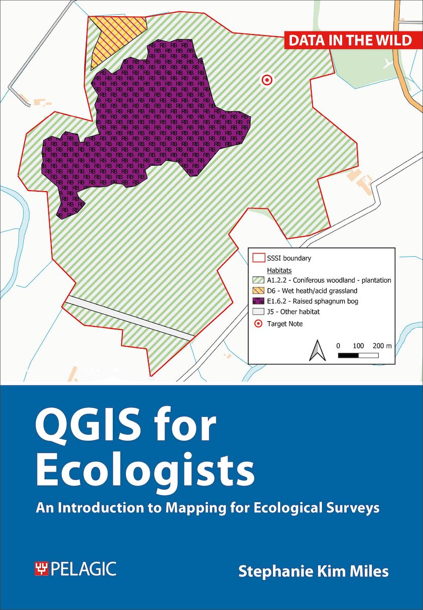
This book teaches the basic stages of mapping for ecological projects. It uses QGIS, an open source system, as this is the most accessible platform to produce maps for reports. The book guides the beginner mapmaker through production of maps for the day-to-day projects of ecologists working in consultancy. If you don’t know where to start or how to use QGIS, this is the practical guide for you. There is no jargon, just everything you require to create the desired maps and to extract from them all the information that you’ll need for reporting.
You will learn how to create several different sorts of maps frequently employed in ecological reports:
- basic survey map
- aerial imagery survey map
- designated sites map
- desk-study map
- protected species map
- habitats map
As a part of this you will also discover how to download third-party maps and datasets, create your own data, geo-reference images and import GPX files into QGIS. Weblinks allow access to downloadable data for use in producing the maps described. The book also includes workflows that you can emulate for your own projects, ensuring that it will remain a helpful tool long after you have completed all the exercises.
Ideal for those working in ecological consultancy and conservation, as well as students with an understanding of ecology and surveying but no background or training in QGIS, this handy book will also be a great help to those needing to refresh their GIS skills and/or looking for workflows to follow.
DOI: 10.53061/IHQS7086
About the Author
Stephanie Miles is GIS Officer for the Bumblebee Conservation Trust and was previously a consultant ecologist specialising in ornithology.Bibliographic Information
 176 pages
 - BISAC SCI020000, TEC036000
- BIC RGW, PSAF, UNC